Hurricane Melissa Barrels Toward Jamaica as a Record-Breaking Category 5 — The Strongest Storm to Ever Hit the Island
Hurricane Melissa has become the most powerful storm in Jamaica’s recorded history, and the images from space tell a chilling story. The Category 5 hurricane, now packing winds of over 175 miles per hour, is churning its way across the Caribbean with a level of force meteorologists are calling unprecedented. As of Monday, October 27, the storm was rapidly intensifying and closing in on Jamaica, marking what could become one of the most destructive weather events to ever impact the region.
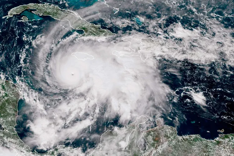
Satellite footage shows Melissa as an enormous, perfectly symmetrical swirl of white, its eye eerily clear and sharply defined — a signature of catastrophic power. Meteorologists say the storm’s central pressure has dropped dramatically over the past 24 hours, a sign that it continues to strengthen even as it approaches land. If it makes landfall at its current intensity, Melissa will be the strongest hurricane ever recorded to hit Jamaica since systematic weather records began in 1851.
Already, the toll has been devastating. At least six people have lost their lives across the northern Caribbean, where Melissa’s outer bands have caused flooding, landslides, and widespread damage to homes and infrastructure. Officials in the Dominican Republic and Haiti have reported hundreds displaced as rivers burst their banks and coastal regions experienced violent storm surges. In parts of Puerto Rico, residents are still recovering from days of heavy rain that preceded the hurricane’s full arrival.
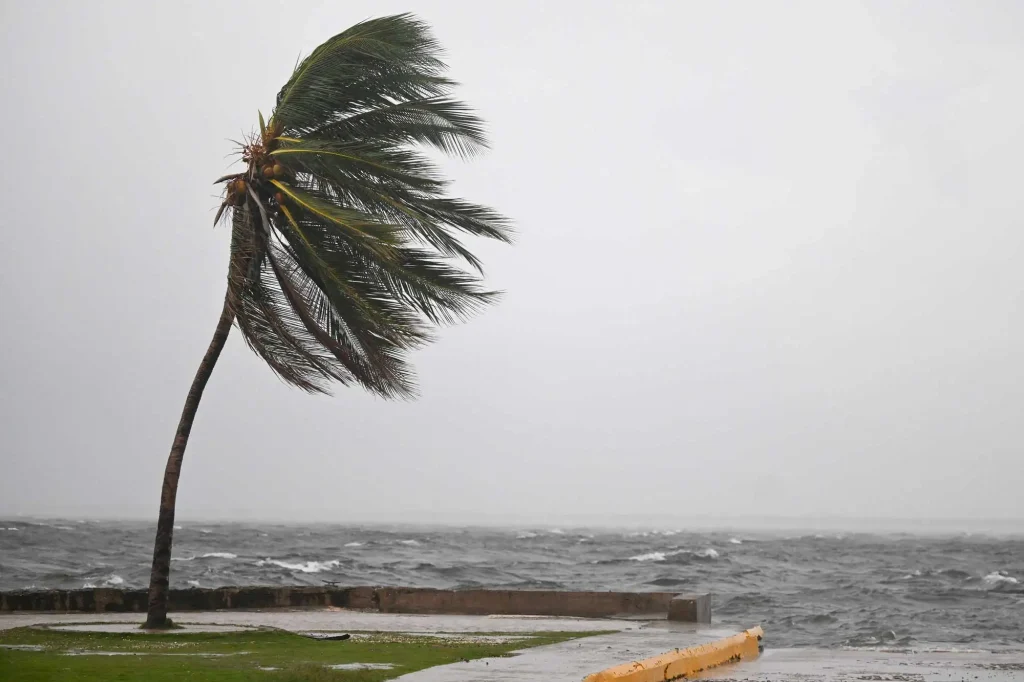
Jamaica now stands directly in the path of the storm, with the government urging citizens to evacuate low-lying areas and seek shelter. Prime Minister Andrew Holness addressed the nation in an emergency broadcast, calling Hurricane Melissa “an unparalleled threat” and pleading with residents to take the warnings seriously. The entire island is under a hurricane warning, with winds expected to reach catastrophic levels by Tuesday, October 28.
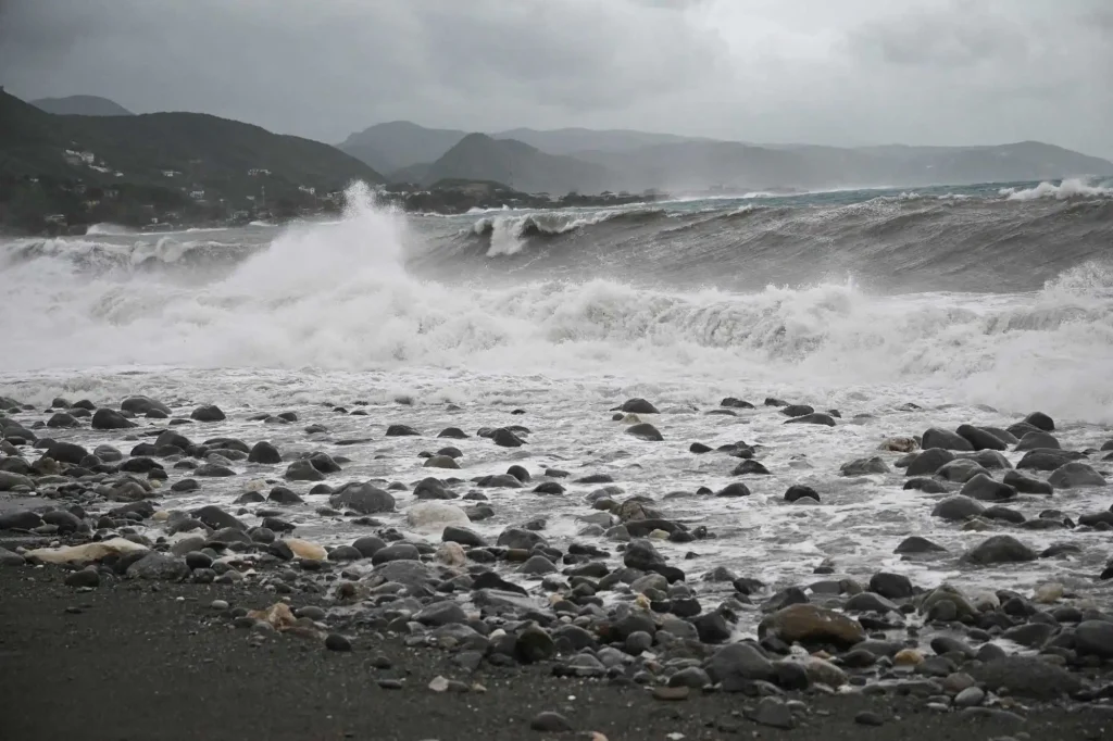
Experts from the National Hurricane Center and the Caribbean Disaster Emergency Management Agency have emphasized that Melissa’s scale is unlike anything seen in recent decades. The storm’s eyewall — the most dangerous part of the hurricane — is nearly 30 miles wide, capable of bringing winds strong enough to tear roofs from concrete homes and uproot trees by the thousands. Combined with torrential rain and storm surges predicted to exceed 15 feet in some coastal areas, the potential for widespread devastation is enormous.
Meteorologists have noted that ocean surface temperatures in the Caribbean are among the warmest on record this year, creating perfect conditions for explosive hurricane growth. The warm water acts like fuel, feeding the storm’s strength and allowing it to intensify more rapidly than older forecasting models could predict. In just 36 hours, Melissa grew from a Category 2 to a top-tier Category 5 — a rate of intensification rarely observed in history.

Across social media, footage from Jamaica shows long lines at gas stations and supermarkets as people prepare for what could be days without power or running water. Hospitals are bracing for impact, with emergency generators being tested and staff mobilized to handle mass casualties if necessary. International aid organizations, including the Red Cross, have already pre-positioned supplies in neighboring islands to assist with relief efforts once the storm passes.
For many Jamaicans, the approach of Hurricane Melissa brings back memories of Hurricane Gilbert in 1988, which devastated the island and left a lasting mark on its infrastructure. But experts warn that Melissa could be far worse. “This storm is larger, stronger, and moving more slowly,” one meteorologist explained on local TV. “That combination is what makes it so dangerous.”
As night falls and the hurricane edges closer, the sense of unease across Jamaica is palpable. The wind is already picking up, the skies darkening even in daylight hours. Locals describe the eerie calm before the storm as power lines sway and the first sheets of rain begin to fall. For now, all anyone can do is wait — and hope that when the winds finally die down, there will still be a home to return to.