Brace for a Winter Blast: NYC Could See Its First Snow of the Season as a Powerful Polar Vortex Sweeps the Tri-State Area
A wave of Arctic air is roaring south, setting the stage for what could be the first snowfall of the season in the New York City area. Forecasters from the National Weather Service and local outlets say the chilling descent of a strong polar vortex will bring sub-freezing wind chills, gusts approaching 40 mph, and a real possibility of snow flurries rolling through the region during the Tuesday morning commute.
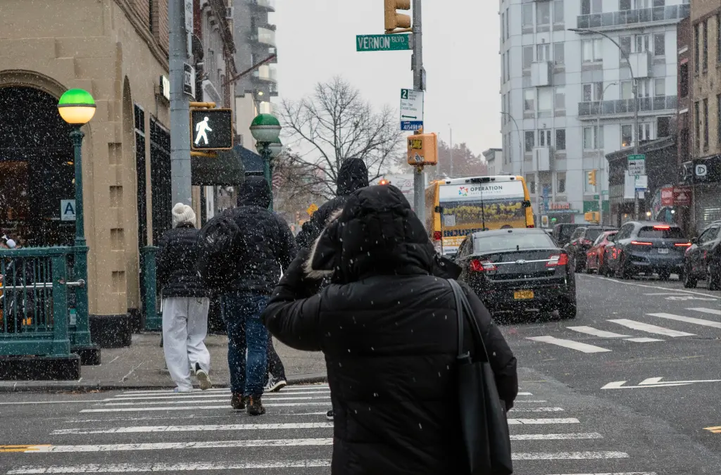
Temperatures already hovered near 40°F Monday evening, with wind-chill values forecast to dip into the mid-20s to low-30s by Tuesday morning. In New York City, that kind of wind-bite can turn ordinary sidewalks slick with frost and send the view of a lazy snowfall into something far more memorable. On Tuesday, scattered snow flurries were expected to drift across the city and suburbs — while accumulation appears unlikely, the symbolic arrival of winter could not be more dramatic.
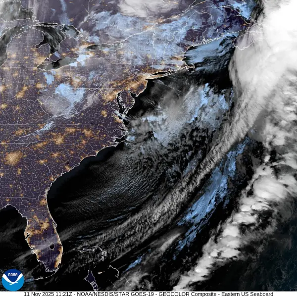
Meteorologists say the key driver behind the cold snap is a downward dip in the jet stream, which allowed Arctic air to funnel from Canada into the Northeast. The result is a widespread freeze warning issued across parts of the tri-state region — and for commuters in New York, a reminder that winter may be arriving ahead of the calendar’s schedule.
In practical terms, for commuters and city dwellers the implications are straightforward. Expect a sharp difference between the temperature outside and the wind-chill: a jacket may no longer suffice, and gloves, a hat, or layers become necessary. City officials are also advising extra caution on sidewalks, bridges, and roadways where frost may form, and urging delayed starts or remote work where possible.
Despite the early timing, this event differs significantly from a full-blown snowstorm. Experts emphasize that while flakes may fall, accumulation is unlikely due to the lack of sufficient moisture in the air over the coastal corridor. Instead, this is a dry chill — the kind that creeps into bones, shifts moods, and signals the turning of seasons more than it blankets the streets.
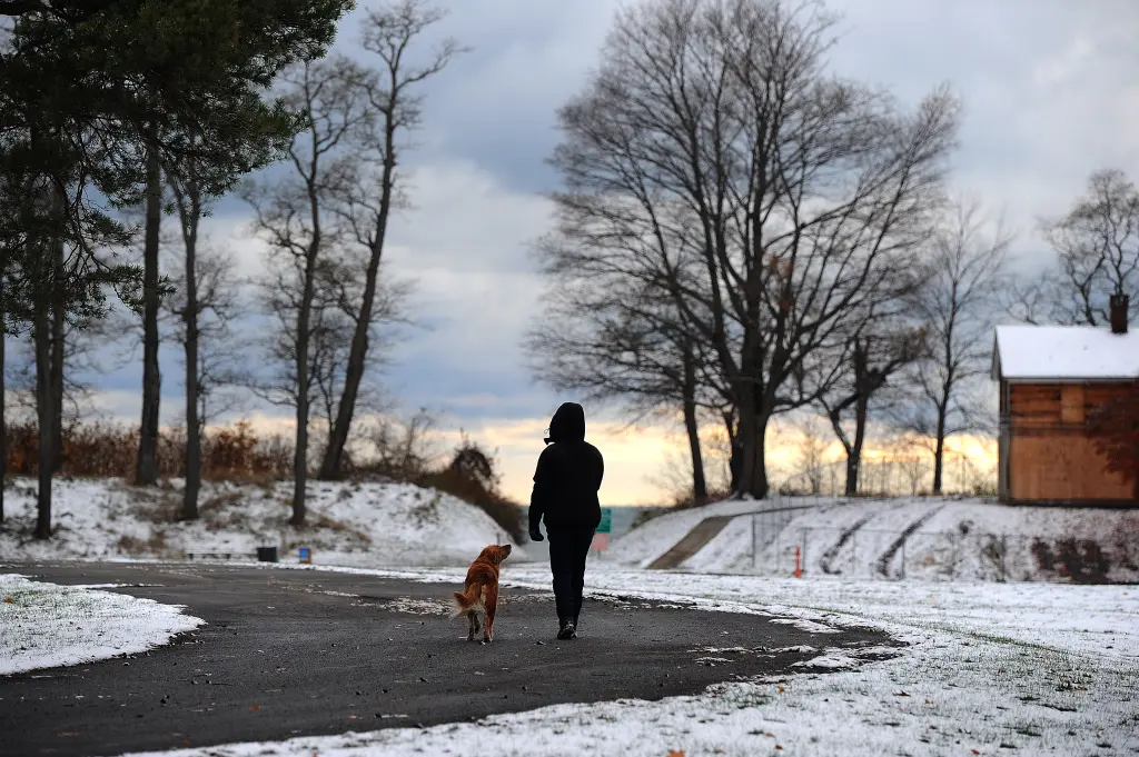
The symbolic first snow has always held a certain appeal in the city: a subtle mark of the transition from autumn to winter, a chance for the skyline to reflect a different light, and for New Yorkers to pause and notice the change. While cresting snowbanks may have to wait, the combination of wind, cold, and a light dusting brings its own resonance.
The broader winter outlook for the 2025–26 season offers a mixed picture. According to meteorologists, the city may see slightly below-average snowfall, with total accumulation projected around 15–20 inches for the season. The forecast also identifies the polar vortex and its potential southward dips as a wildcard factor for significant winter events.
For now, the focus is on the immediate challenge: a morning of brisk wind-chills, the possibility of a few flakes, and the early onset of winter’s attitude. City services and agencies remain on heightened alert — not necessarily for a major storm, but for the kind of slippery conditions and commuter surprises that accompany a sudden blast of cold.
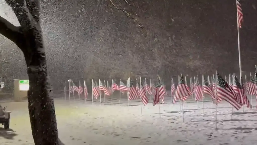
As dawn breaks over Manhattan and the Hudson glimmers under a pale sky, the arrival of even a few dustings of snow will be a photographic moment. New Yorkers bundled against the wind can look out across streets, waterways, and the changing seasons. This year, the first snow may arrive as a whisper rather than a shout, but its presence will matter all the same.
The National Weather Service has described the system as a “classic early-season Arctic intrusion,” noting that temperatures could remain below normal for the next several days. Gusts of 30 to 40 mph may make it feel closer to the 20s, especially near open areas like the Hudson River, East River crossings, and along the coastline. Overnight lows could sink near the freezing mark across the city and into the upper 20s in parts of New Jersey and the Hudson Valley.
While not a major event, meteorologists see the pattern as an early preview of what’s to come later in the season. The polar vortex’s arrival this early suggests a stronger, more dynamic winter jet stream that could allow similar bursts of Arctic air to reach the city again in December and January. Historically, such setups have preceded winters with frequent cold spells and quick-moving clipper systems that can bring light snow events to the Northeast.
For residents, it’s a cue to prepare — checking heating systems, stocking winter supplies, and watching for any changes in long-range forecasts. For schools and public agencies, it’s a test run for the winter-response machinery: salting trucks, plows, and emergency communication lines are being checked and staged across the city.
Across the tri-state area, the story is much the same. Northern New Jersey, the Hudson Valley, and parts of Connecticut are bracing for stronger winds and colder air, with morning lows dipping into the 20s. In upstate New York, the first measurable snow of the season could accumulate lightly in areas like Albany and Syracuse, while the Catskills and Adirondacks may receive a dusting on higher elevations.
For millions of commuters, though, the reality is simpler. The first snow — even if only a flurry — marks the psychological start of the long cold stretch that defines winter in the city. Scarves and gloves return, steam clouds rise from subway grates, and the gray palette of the streets acquires its first hint of white. It’s a shift as much in spirit as in weather.
By midweek, the Arctic air mass is expected to linger, keeping daytime highs in the low 40s and overnight lows hovering near freezing. A gradual rebound toward milder conditions is expected late in the week, but forecasters caution that the pattern could reassert itself multiple times this season.
For the city that never sleeps, the first snow often comes with both inconvenience and wonder. It slows taxis and buses, but it also quiets the streets; it coats Central Park in a fleeting shimmer and makes even the most hurried pedestrians look up, if only for a moment. The contrast between steel towers and soft snowfall is one of New York’s oldest winter rituals.
And while this first brush with winter may not leave much behind, it’s a signal — the Arctic is stirring, and the city’s long cold months have begun. Whether the flakes fall for minutes or hours, they carry with them the unmistakable feeling that another season has turned, and the rhythm of New York has shifted once again.